Meteorological environment monitoring equipment supplier
Insist on doing high-precision customer favorite technology products

Meteorological environment monitoring equipment supplier
Insist on doing high-precision customer favorite technology products

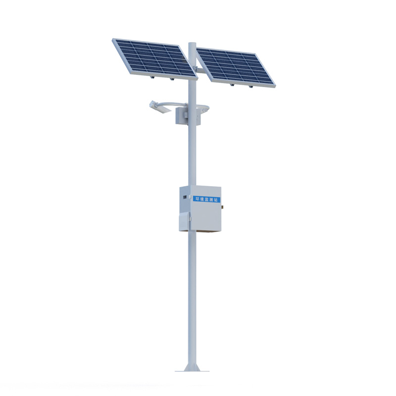
Visibility Monitoring System consists of a networked array of monitoring stations deployed along highways. Each station integrates sensors, data collectors, mounting poles, power supply units, and a cloud platform to provide real-time measurements of visibility during various weather conditions—such as fog, rain, and snow—making it suitable for applications in meteorology, aviation, and transportation.
Visibility Monitoring System is a specialized equipment system designed for the real-time measurement and recording of atmospheric visibility conditions. The system comprises a network of multiple monitoring stations distributed along highways; each station independently performs data acquisition, utilizing a cloud platform to facilitate remote transmission and centralized management.
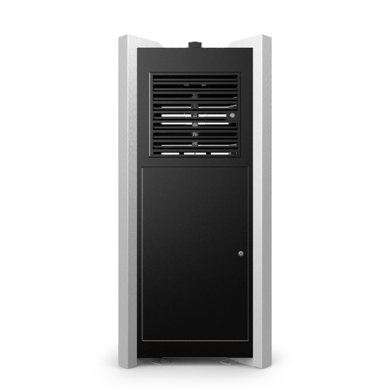
A standard visibility monitoring station consists of five core components. The visibility sensor is responsible for directly measuring the scattering or transmission characteristics of the atmosphere, outputting a specific visibility value. The data collector processes and stores the sensor signals, while also controlling the data upload frequency. The mounting pole provides a stable installation height for the sensors and collectors, minimizing interference from ground-level obstructions. The power supply system typically utilizes solar panels paired with backup batteries to ensure the monitoring station operates continuously in remote field environments lacking access to external power sources. Acting as a central data hub, the cloud platform receives real-time data uploaded from each station, providing a visualization interface and capabilities for querying historical data.
Regarding weather phenomenon identification, Visibility Monitoring System is capable of distinguishing between various states, including fog, rain, snow, mixed precipitation, and clear skies. Under different weather conditions, the concentration and size of atmospheric particulates or water droplets directly influence the distance over which light can propagate; the system employs optical principles to precisely measure this distance, thereby deriving accurate visibility values. Measurement results are displayed in units of meters or kilometers, with the measurement range automatically adjusting based on the actual visibility conditions.
Highways represent a key application scenario for Visibility Monitoring System. In critical locations—such as sections prone to sudden "patchy fog," bridges, and tunnel entrances/exits—monitoring stations are deployed at intervals of several kilometers to form a dense monitoring network. When visibility in a specific road section drops below a predetermined safety threshold, the system automatically issues a warning, providing essential data support to traffic management authorities for implementing speed limits, closing roads, or issuing traffic guidance information. Meteorological stations also utilize this system to supplement their ground-level visibility observation data, thereby enhancing the accuracy of local weather forecasts. The measurement of runway visual range at airports similarly relies on high-precision visibility sensors, directly influencing decisions regarding flight takeoffs and landings. Airlines consult en-route visibility data during flight planning, while large vessels entering or exiting ports must also rely on visibility information to assess navigation conditions.
From a technical perspective, the measurement accuracy of the Visibility Monitoring System system is influenced by sensor selection, the installation environment, and maintenance frequency. Forward-scatter sensors and transmissometers represent the two primary sensor types; the former is typically suited for general road monitoring, while the latter is predominantly deployed in environments with more stringent accuracy requirements—such as airports. Built-in algorithms within the data collector filter and correct raw data, thereby eliminating interference factors such as stray light and lens contamination. The power supply system's endurance during prolonged periods of overcast or rainy weather—combined with the data stability of the cloud platform—collectively determines the overall reliability of the entire system.
The networking capabilities of the Visibility Monitoring System system enable cross-verification of data from multiple points, thereby preventing information gaps caused by the failure of a single monitoring station. Once the cloud platform aggregates data from all stations, it can generate visibility distribution maps along the route, providing a visual representation of the extent and movement trends of low-visibility zones. For cross-regional management purposes, monitoring data from various road segments can be integrated—via standard interfaces—into higher-level traffic or meteorological information systems, thereby facilitating data sharing.
As safety standards within the transportation sector continue to rise, the Visibility Monitoring System system has emerged as a foundational component of infrastructure designed to mitigate the impact of severe weather conditions. Its measurement outputs serve not only to generate real-time alerts but also to accumulate long-term statistical datasets, providing essential reference data for road design and the optimization of meteorological services.
Sales Manager:Ms. Emily Wang
Tel, Whatsapp:+86 15898932201
Email:info@fengtutec.com
Add:No. 155 Optoelectronic Industry Accelerator, Gaoxin District, Weifang, Shandong, China